So far this season there have been four forest fires in the area, all of them still burning fiercely out of control or mostly contained. Two are to the east in the Pecos Mountain area, one to the northwest and one west, just past Los Alamos in the Jemez Mountains at Valles Caldera National Preserve.
Valles Caldera is a 13.7 mile wide bowl, the remains of a small supervolcano that last blew its top about 50,000 years ago. Fragments of the explosion have been found as far away as Lubbock, Texas. Today the area serves as a magnificent location for cross-country skiing, fishing, horse riding and Hollywood movie-making.
A view from my back yard, looking east, to the second fire in the Pecos Wilderness area.

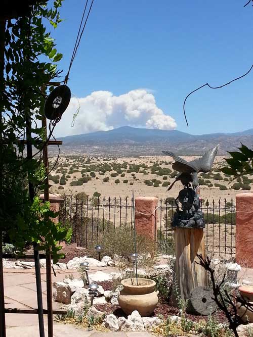
A view from the nearby ‘town’, looking east, to the first fire in the Pecos area.

A view from my front yard, looking west, to the fire in the Jemez Mountains. The lights in the center of the photo are from Los Alamos, site of the Manhattan Project.
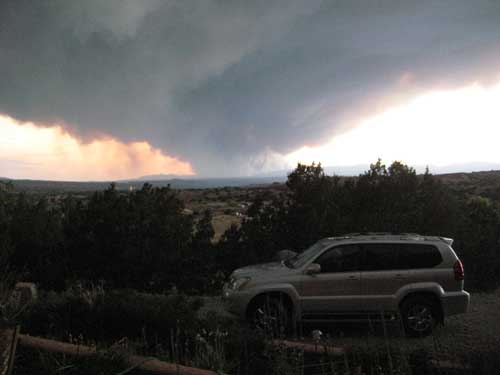
A view from my front yard, looking west, to the 2011 Las Conchas fire in the Jemez Mountains. It came within 50 feet of the 30,000 fifty gallon barrels of Los Alamos nuclear waste that are stored under tarps near the small neighboring town of White Rock. We could never figure out what those white structures were until then. As one can see, the smoke and ash drifts 20 miles directly toward the house. In the first day this fire consumed 43,000 acres – about one acre per second!

A view from my back yard, looking east, to the 2011 Pacheco forest fire that made us all pack and prepare to split for safety.